Clean and Green

Anticipated Traffic Impacts of Light Rail Transit (LRT) on Hamilton

Challenge:
How might the LRT project affect traffic on the LRT Corridor and alternative routes, the economic growth of the downtown core, and provide health and environmental benefits to the community?

Student Names:
Anastasia Soukhov, Cole Bondarewski, Chris Leung, Amanda Reale, Mike Wang, Julian Riano, Stanley Qian, Andrea Giampuzzi, Justin Lawrence, Andres Alvarez

Staff Member:
Kris Jacobson, Acting Director, LRT Project Coordination

Instructor:
Moataz Mohamed

Course and Department:
CIVENG 4T04 Transportation Engineering II: Modelling, Transit, and ITS


The Hamilton LRT project is part of the Ontario government’s commitment to expanding transit in the Greater Toronto and Hamilton Area. This project presents a great opportunity for students to study the effects of the LRT on different aspects of the community. Questions surrounding projected traffic congestion, property values, anticipated employment growth, and improved environmental conditions due to decreased daily travel times and fuel consumption, can be explored.

Students of the McMaster Transportation Engineering class created a traffic simulation of the current and projected conditions on a section of King Street near McMaster University. They used statistical models to project current traffic data into the future. Students optimized LRT riders' travel times using a micro traffic simulation model. They consulted literature for additional traffic assignment modelling assumptions and reviewed literature discussing the economic and environmental impacts of the LRT project on Hamilton's community. 

Next students will generate suggestions to highlight the impacts of LRT and share their findings with community stakeholders. 

       Traffic assignment equilibrium loop

       Traffic assignment equilibrium loop

                                                                      &nbs…

                                                                           Hamilton LRT Render

                                         Traffic simulation of projected data using Synchro 5


                                        Traffic simulation of projected data using Synchro 5

Slide1.jpg

Red Light, Green Light

Challenge:
How can we minimize the impact of the LRT on the major signalized intersections of the downtown core?
Lights

Lights

Student Names:
Kerianne Hagan, Jessica Middleton, Jedursha Thurappah, Peter Ivankovic, Alyson King

mcmaster-logo.png

Staff Member:
Kris Jacobson, Acting Director, LRT Project Coordination

Instructor:
Moataz Mahmoud

Course and Department:
Civil Engineering 4T04: Transportation Engineering II - Modelling Transit and ITS

Traffic simulation of projected data using Synchro 5

Traffic simulation of projected data using Synchro 5

Kerianne, Jessica, Jedursha, Peter and Alyson - Civil Engineering students at McMaster University, counted vehicles at the five major intersections of Catherine, John, James, MacNab and Bay. They then modelled construction drawings of the proposed layout and input their collected data using the Synchro 5 software. This optimized the traffic signals of the 5 intersections to give the LRT priority. 

Next they will generate suggestions to highlight the impacts of LRT and share these findings with community stakeholders. 

Rendering of LRT

Rendering of LRT

LRT B-line Map

LRT B-line Map

Corner of King and Wellington Street, Hamilton

Corner of King and Wellington Street, Hamilton

Anticipated Traffic Impacts of LRT on Hamilton-1.jpg

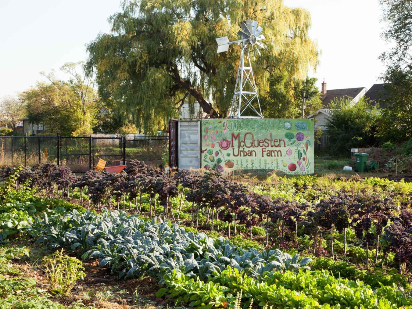
Growing Bridges: Improving Regional Food Security by Increasing Engagement at the McQuesten Urban Farm

Challenge:
What are the barriers that McQuesten residents experience when engaging with the McQuesten Urban Farm?

Students:
Muhammed Aydin, Katheleen Eva, Jethro Krause, Ikra Saeed

Staff:
Adam Watson: Project Manager, Neighbourhood Action Strategy   Jocelyn Strutt: Project Manager, Neighbourhood Action Strategy

Instructor:
Kate Whalen

Course and Department:
Sustainability 4S06: Leadership in Sustainability, Academic Sustainability Programs

Response to the question- “Is there something in particular that you’d like them to do at the farm to help engage you?” (Carrot = 2 persons) (Created by Ikra Saeed)

Response to the question- “Is there something in particular that you’d like them to do at the farm to help engage you?” (Carrot = 2 persons) (Created by Ikra Saeed)

A 2010 report highlights that 24 million individuals in North America alone live in a food desert, locations in which access to affordable, healthy food options are limited or nonexistent. Furthermore, many of these individuals were found to be of lower socioeconomic status. The McQuesten neighbourhood in Hamilton, Ontario has been perceived by its community members to be a food desert, with the closest grocery store being over a 20-minute walk away. The McQuesten Urban Farm was created with the purpose of building the capacity of the community, increasing food security, and reinforcing that everyone has a right to nutritious food. However, there is lower than anticipated engagement among community members. This project’s research will focus specifically on those that live within CityHousing Hamilton (CHH) and nearby Melvin Avenue apartment buildings.

Muhammed, Kathleen, Jethro and Ikra from the McMaster's program in Sustainability hosted conversations with local researchers and experts on food security and community engagementconducted surveys in the McQueensten neighbourhood in three CityHousing Hamilton including one high rise apartment community: 4 days, 281 doors, 76 resident interviews. They used this data to create hypothesis and implementation engagement strategies as well as a customer management tool and volunteer tracking management tool to improve data gathering. They then created and distributed improved marketing materials and research results to the local community. 

Next the students will integrate the tools created into the upcoming growing season at the McQuesten Urban Farm, so that data based decision making can continue to improve operations while exploring further partnerships through CityLAB to continue to increase engagement levels. 

Growing Bridges poster-1.jpg

School Site Design Study: Impact of School Site Paved Surface Area on Travel Mode Choice

Challenge:
Is there any relation between paved surface area of school sites and the modes of transportation used to get to school?
Observing the number of vehicles coming and going

Observing the number of vehicles coming and going

Students:
Mina Mahdavi, Kamaldeep Kaur

Staff Member:
Kelly Scott, Physical Activity Specialist, Healthy Environments Division, Healthy & Safe Communities Department

Instructor:
Gail Krantzburg

mcmaster-logo.png

Course and Department:
Thesis project, W. Booth School of Engineering and Practice


In the Greater Toronto and Hamilton Area (GTHA), there has been a steady decline in walking to and from school over the past 25 years, as children are increasingly dropped off and picked up by car. Data drawn from the 1986 to 2011 Transportation Tomorrow Survey shows that walking among 11 to 13 year olds in Hamilton has decreased from 58% in 1986 to 39% in 2011. This increase in car travel mode share to school in the GTHA, has added significant car traffic volume to roads during the morning peak period. Now schools are the second biggest car trip generator in the morning commute forming 22% of morning peak traffic, second only to workplaces, in the GTHA.

This project builds on the previous study “School Site Design and Travel Mode Choice: A Comparison of Objective and Subjective Measures of Walk ability of Schools in the Hamilton Area” completed February 2017.  The draft hypothesis for this project is “as the amount of school site motorized vehicle paved surface area increases so too does the use of motorized vehicles to the school site and surrounding streets”.  The information is intended to inform decisions about school site design that promotes the greatest mode share of walking and cycling, while reducing personal motorized vehicle use. 

  • Research indicates that there is a link between the built environment, and individual and population health

  • Sedentary behaviour and physical inactivity have been linked to an increased risk of chronic diseases

  • Travel by motorized vehicles (personal vehicles & school buses) negatively impacting pedestrian and cyclist safety

  • Motorized vehicles contribute to air pollution and greenhouse gas emissions that adversely impact respiratory and cardiac health

  • Availability of free parking and ‘kiss-and-rides” increases the use of motorized vehicles

Mina and Kamaldeep received ethics approval from the McMaster Research Ethics Office and the municipal school boards to observe 14 schools and collect data on the relationship between paved surfaces and modes of transportation. They will next interpret the data to determine relationships and provide recommendations for schools based on their findings. 

School Site Design Study-1.jpg